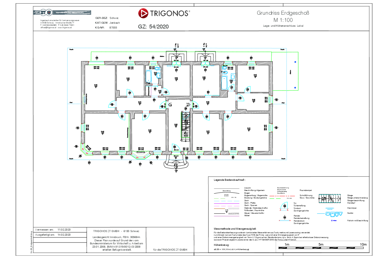
2D As-Built Plans
While 2D as-built plans were traditionally created using tachymetric surveys on site, today the point cloud also serves as the primary basis for digitalization. From this 3D dataset, floor plans, sections, elevations and facade drawings can be derived and prepared according to the required level of detail.
Advantages at a Glance
- Short on-site time for the survey team results in minimal disruption to operations
- Reduced time requirements due to a high level of digitization and automation
- Cost-efficient thanks to minimized personnel requirements
- Tailored digital planning bases for renovation, extensions and conversions
- Accurate representation of all captured elements
- Complex geometries such as trusses, roof structures or vaults are clearly represented
- Complete data capture ensures a consistent and comprehensive 2D plan set
Fields of Application
Industry, energy sector, construction, infrastructure,
architecture, heritage conservation and many more

Plans as a Basis for Extensions and Conversions
In many cases, no plans exist or only outdated sketches or incomplete drawings are available. Even with older digital plans, it cannot always be assumed that construction was carried out exactly according to the drawings. If it becomes apparent that planning-relevant elements for an extension or conversion are missing or incorrectly represented, a new survey is required.
When re-measuring with simple tools such as measuring tapes or laser distance meters, only rough control dimensions can usually be taken. Elements that are difficult to measure – such as wall thicknesses between rooms, floor slabs or deformations in structural components (for example bulging walls) – cannot be captured reliably. This is exactly where our approach comes in: using laser scanning technology, we generate millimeter-accurate CAD plans.
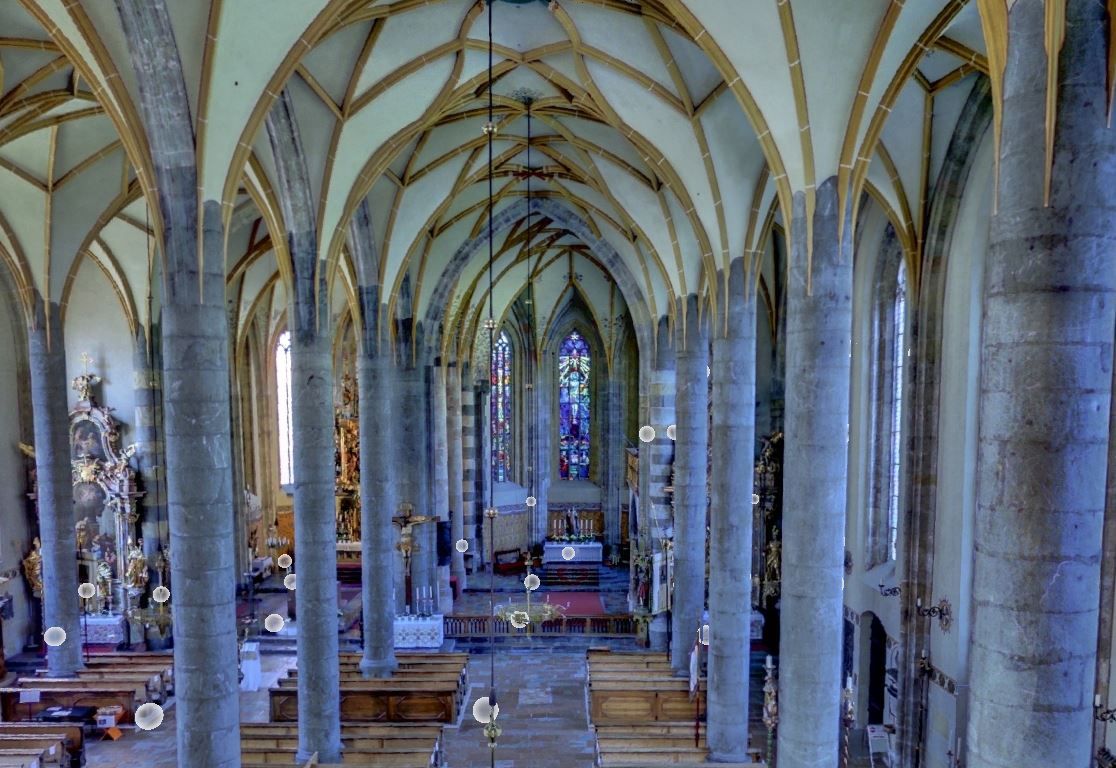
Heritage Protection and Archaeology
For protected historical buildings, deformation-accurate as-built plans are created for archival purposes as well as for the planning of renovation or reconstruction measures. Structural elements such as façades, domes, vaults and archaeological structures can be measured quickly, precisely and completely contact-free using laser scanning technology.
This highly accurate documentation of historically valuable structures forms the basis for floor plans, sections, elevations, orthophotos (in grayscale and color) and photorealistic 3D models. These plans are prepared in accordance with ÖNORM A 6250-2.
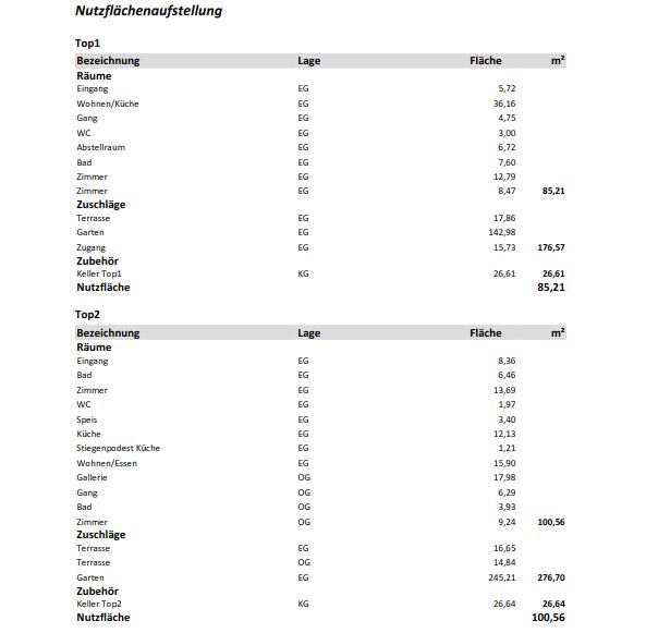
Plans as a Basis for Property Partitioning Reports
Property partitioning (valuation reports determining usage shares) is required when a property is divided among multiple owners. To determine the exact ownership shares, various parameters must be documented.
These include the size of individual rooms, garden and parking areas, or shared spaces such as staircases, as well as the ceiling heights of the rooms. All information relevant for calculating usage values is clearly documented in detailed floor plans.